While thousands of people drive through Quaker Hill each day, few realize the 40.5 acres of conserved land sit just off Route 32.
Down Benham Avenue, several trails branch off from the side of the road. These are entrances to the Mamacoke Island Natural Area. More trails and parking spaces can be found at the bottom of the hill by the train tracks. The entire area is owned and monitored by Connecticut College.
Everyone is welcome to walk the trails although bikes, pets, runs, and camping activities are prohibited. An alternate way to the Island can be found by walking along the train tracks. The tracks are active and although the trains rarely pass, it is still advised to take extreme caution and stay on the side paths.
The salt marsh connects the island to the mainland, making it a peninsula. It often gets flooded and is difficult to cross during heavy rain and high tides, so check the tide charts. This marsh is special, it is one of the only unditched salt marshes in Connecticut. Starting in the 1930s and continuing until the 1960s, 90% of the salt marshes on the east coast were grid ditched. The Civilian Conservation Corps (CCC) would ditch these marshes to drain pools of water to control the mosquito population. Grid ditching seemed like a smart move at first, but over time it led to increased erosion, damaging the water table which led to dried out marsh and overall ecological issues.
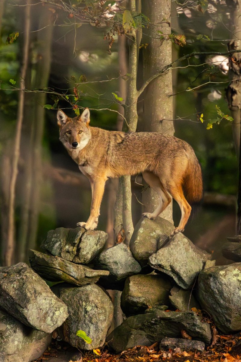
The salt marsh isn’t the only special thing that Mamacoke holds. The natural area has a wide range of biodiversity. During all seasons, walkers can find white tailed deer, coyotes, crabs, shellfish, and many varieties of local birds including cardinals, blue jays, snowy egrets, woodpeckers, belted kingfishers, black-capped chickadees and ducks. During the spring, ospreys, terrapins, red tailed hawks, and other mammals return to the island. The winter brings along other species. Bald eagles, harbor seals, snowy owls, and tons of waterfowl. Mamacoke also has a lot of biomes, mixing salt marsh vegetation, upland forest, freshwater plants and native eastern North American greenery.
Mamacoke Island Natural Area started with thousands of years of Indigenous use, acting as a Pequot and Nehantic ancestral site. This was discovered in 1927 when local children uncovered two human skeletons and a small collection of projectile points. From 1647 to 1940 the island served as part of the Mamacoke farm. This was owned by the Rogers family until John Rogers Jr. split the land into three, creating the Avery and Matthies tracts following his death in 1753. Their gravesite can be found by a small stream located over by the old rugby field at Connecticut College. Since then, the natural area has had many additions, including a shipyard, gun emplacements during the Second World War and also being purchased by the Merritt-Chapman & Scott Corporation. This came to an end when both of the tracts were purchased by Connecticut College in 1944, with the Island being bought in 1955. The original plan cleared out trails for their riding program but by 1954 riding was no longer accessible as Route 32 had become too busy. It wasn’t until 2006-2008 that the land had become an official conservation and named an important bird area by the Audubon Society.
Mamacoke Island is a hidden gem. Its diverse ecosystems and conservation efforts are an amazing place to take a hike, learn about and view local wildlife, or just explore the natural area peacefully.

Kristin G • May 7, 2026 at 9:15 am
What a wonderfully written story, and an amazing picture of the Coyote!